What does it actually feel like to live near one of Raleigh’s greenways? For many buyers, that question matters just as much as square footage or finishes. If you are trying to picture daily life in Raleigh, the city’s trail network can tell you a lot about how a neighborhood functions, how people move through it, and what kinds of routines are easy to build. Let’s take a closer look.
Why greenway access matters
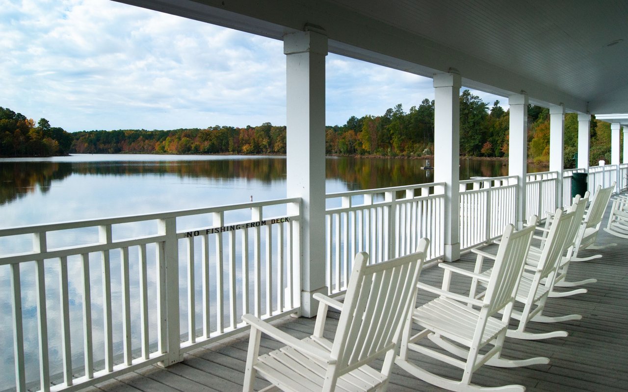
Raleigh’s Capital Area Greenway System is a major part of how many residents experience the city day to day. According to the City of Raleigh’s greenway information, the network includes 117 miles of trails along streams, the Neuse River, and tributaries, with 28 trails designed for walking, cycling, wheelchair and scooter use, commuting, exercise, and nature access.
That range of uses is important. In some places, a greenway is where you go for a long run or bike ride. In others, it becomes part of a normal weekday, giving you a route to a park, a shopping area, or another part of the neighborhood without always getting in the car.
It is also worth knowing that Raleigh’s system is not all one thing. The city says most greenways are 10-foot asphalt paths, but some segments are natural-surface trails and about 8 miles are roadway-adjacent sidewalks, as shown in the Capital Area Greenway System overview. That means the experience can change quite a bit depending on where you live.
What everyday greenway life looks like
In practical terms, greenway-connected living often means your routine has more options. You may head out for a short morning walk, bike to a nearby park, connect to a longer weekend route, or turn a trail outing into a stop at a playground or lake.
Raleigh supports that lived-in feel through its parks system as well. The city has more than 200 parks, and greenway-related food vendors are placed at popular locations such as Lake Johnson, Shelley Lake, John Chavis Memorial Park, Walnut Creek Wetland Center, and Anderson Point. Small details like that can make trail access feel like part of real daily life instead of a once-in-a-while amenity.
The city also provides tools that make the system easier to use. The Greenway Explorer map helps users find trailheads, parking, restrooms, bike repair stations, dog parks, playgrounds, and parks. For buyers comparing neighborhoods, that matters because convenience is often what turns nearby trails into a habit.
Not all greenway access feels the same
One of the most useful things to understand when you are comparing Raleigh neighborhoods is that greenway access is not uniform. Some corridors feel wooded and quiet. Others function more like street-connected links that improve walkability between destinations.
That difference shows up throughout the city. A lake loop, a creekside corridor, and a sidewalk-style connector can all count as greenway access, but they support different lifestyles. If a trail is high on your list, it helps to look beyond the map and think about how you would actually use that segment week to week.
It is also smart to remember that access can change. Because many greenways follow waterways and flood-prone areas, the city notes that closures and detours can happen due to flooding, maintenance, sewer work, or construction. In other words, greenway living is a real benefit in Raleigh, but it is not always a fixed, uninterrupted experience.
North Raleigh and Midtown connections
For buyers who want a strong mix of neighborhood convenience and trail connectivity, North Raleigh and Midtown stand out. The Crabtree Creek Trail runs 18 miles from Umstead State Park to Anderson Point Park and connects places including Crabtree Valley Mall, Kiwanis Park, Lassiter Mill, North Hills Park, Mine Creek, and House Creek.
That kind of network can support a very practical routine. You may have access to short neighborhood walks, longer loop runs, park visits, and connections to shopping areas, all through the same broader corridor. Mine Creek also connects to Shelley Lake, and Snelling Branch extends from Shelley Lake to Optimist Park, which adds even more variety to how the area feels day to day.
Midtown is also seeing new connectivity improvements. The Big Branch Greenway Connector is expected to expand the system by more than three miles and improve links to parks, shopping, transit, and future bus rapid transit stops. The city says it will place nearly 7,000 neighborhood residents within a short walk of the greenway and eventually benefit more than 10,000 residents.
West Raleigh and Lake Johnson routines
West Raleigh offers a different version of greenway-centered living, one built around recreation, lake access, and longer connected routes. Lake Johnson Park is one of the clearest examples, with paved greenway loops, natural-surface trails, fishing, paddling and sailing programs, rentals, a pool, accessible amenities, and environmental education.
If your ideal routine includes a lake loop before work or a weekend outing that mixes exercise with leisure, this area has a lot to offer. The setting supports both quick daily use and longer visits, which makes it appealing to buyers who want more than a simple walking trail.
This part of Raleigh also connects into a broader network. Walnut Creek Trail runs 15.6 miles from Lake Johnson to the Neuse River Trail, while Reedy Creek runs from Umstead State Park through the North Carolina Museum of Art and Meredith College, and House Creek links Crabtree Valley Mall to Wade Avenue. Together, these routes support everything from casual walks to longer bike rides across multiple parts of the city.
Downtown and Southeast Raleigh access
If you want greenway living that feels tied directly to city life, downtown and Southeast Raleigh are especially interesting. The Little Rock Trail connects Walnut Creek Wetland Park, City Cemetery, John Chavis Memorial Park, and downtown, showing how trail use here can be part of everyday urban movement rather than a separate park experience.
This area also brings together recreation, culture, and community spaces in a very visible way. Walnut Creek Wetland Park includes public restrooms, water fountains, classrooms, accessible leisure areas, a bike repair station, environmental programming, a community food forest, and public art tied to surrounding neighborhoods.
The planned Chavis-Dix Strollway adds to that story. The city describes it as a 1.3-mile cultural trail linking John Chavis Memorial Park with Dorothea Dix Park through Historic Fourth Ward and South Park. For buyers who want neighborhood character paired with outdoor access, this part of Raleigh offers a more urban version of greenway-connected living.
East and Northeast Raleigh corridors
On the east and northeast side of the city, the scale changes. The Neuse River Trail is Raleigh’s flagship long-distance corridor, with 27.5 miles of paved trail featuring wetlands, boardwalks, interpretive signs, historical sights, agricultural fields, and access to canoeing, kayaking, and fishing.
This is often the best fit for buyers who picture longer workouts, river access, and broad park connectivity. The trail also connects to Anderson Point Park, Buffaloe Road Athletic Park, and Abbotts Creek Trail, which creates a bigger recreational network than many buyers expect when they first start exploring Raleigh.
Abbotts Creek extends that connectivity toward Falls River Town Center, Green Hills County Park, Durant Nature Preserve, and the Simms Branch corridor near Durant Road. If you are comparing suburban-feeling areas and want trail access to remain part of everyday life, this side of Raleigh deserves a closer look.
How to think about greenways when home shopping
If greenway access is important to you, the goal is not just finding a home near a line on a map. The better question is how that access fits your real routine.
A few practical questions can help:
- Do you want paved paths for walking, biking, or mobility access?
- Would you use a wooded creek corridor, a lake loop, or a sidewalk-style connector most often?
- Are nearby amenities like restrooms, parks, playgrounds, or bike repair stations important to you?
- Do you want a trail mainly for recreation, or would links to shopping, parks, and transit matter too?
- How important is it to have multiple trail options nearby in case of detours or flood-related closures?
These details often shape how a neighborhood feels after move-in. Two homes may both advertise greenway access, but the day-to-day experience can be very different depending on the corridor and connections.
Why local guidance helps
In Raleigh, neighborhood lifestyle is often defined by small geographic details. A home may be close to a trailhead, near a longer connected corridor, or technically adjacent to a segment that functions more like a sidewalk link than a park-like path. Those distinctions are easy to miss if you are only looking at listing photos or broad area descriptions.
That is where experienced local guidance can make a real difference. If you are trying to match your home search to the way you actually live, from Midtown trail access to Lake Johnson loops to Neuse River connectivity, it helps to work with someone who understands Raleigh at the street level.
If you are considering a move in Raleigh and want help finding the right neighborhood fit, connect with John Merriman. With deep local experience and a client-first approach, he can help you evaluate not just the house, but the daily lifestyle that comes with it.
FAQs
What is Raleigh’s Capital Area Greenway System?
- Raleigh’s Capital Area Greenway System is a 117-mile network of 28 trails used for walking, cycling, commuting, exercise, wheelchair and scooter use, and nature access, according to the City of Raleigh.
Are Raleigh greenways mostly paved?
- Yes. The city says most greenways are 10-foot asphalt paths, though some segments are natural-surface trails and about 8 miles are roadway-adjacent sidewalks.
Which Raleigh areas feel most greenway-connected?
- Based on city trail pages, some of the clearest greenway-connected areas include North Raleigh and Midtown around Crabtree Creek and Shelley Lake, West Raleigh around Lake Johnson and Walnut Creek, downtown and Southeast Raleigh around Little Rock and Chavis, and East Raleigh along the Neuse River corridor.
Can Raleigh greenways support everyday errands and commuting?
- Yes. The city describes the network as useful for commuting, recreation, exercise, and play, and newer projects are designed to improve links between neighborhoods, parks, shopping, and transit.
Do Raleigh greenways ever close بسبب flooding or construction?
- Yes. The city notes that closures and detours can happen because of flooding, maintenance, sewer work, or construction, so access may vary over time.